
This article contains affiliate links that may earn me a small commission at no extra cost to you. As an Amazon Associate, I earn from qualifying purchases. For more information, see our affiliate disclaimer.
If you’re planning a road trip along Chile’s famous Carretera Austral (aka the Southern Highway, aka Ruta 7), you will undoubtedly board a ferry at least once.
This raw and rugged region is full of fjords, islands, glaciers and mountains that make constructing roads pretty tricky. Enter: ferries.
The 1,240 km ‘highway’ is interrupted by fjords in three locations, and the only way to continue is via ferry. Seriously, if you look at the map, the highway runs through the water!
If you want to drive the entire length of the Carretera Austral from end to end, you will need to take three ferries. In addition, there are more than half a dozen other ferry routes in the region, offering alternative entry/exit points to the highway.
Ferries are a way of life in Chilean Patagonia, but they can be confusing and intimidating for first-time visitors. Finding information about timetables, prices, and tickets can be a little tricky. Throw in the pressure of ferries booking out in the peak summer months, and it can be a spanner in your Carretera Austral planning process.
I’ve compiled all the info you need to know about the Carretera Austral ferries that you have to take if you want to drive the entire highway, as well as brief information about other possible routes in the region that you might use to enter or exit the highway.
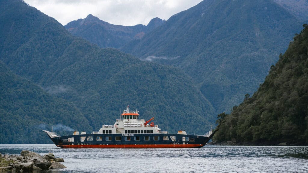
Mandatory Carretera Austral ferries
If you want to drive the entire Carretera Austral, from the starting sign in Puerto Montt to where the road ends in Villa O’Higgins, you must take three ferries. If you look at the highway on the map, these ferry routes are part of it!
You can board as a foot passenger, or with a bicycle, a motorbike or a vehicle. It’s always a good idea to arrive at the port ~1 hour before departure (even if you’ve pre-booked a ticket) to ensure you get on the boat, especially if you’re driving on with a vehicle.
From north to south, these are the three unavoidable Carretera Austral ferries if you’re following our Carretera Austral road trip itinerary from end to end.
🇨🇱 Don’t forget to browse all our posts about the Carretera Austral for more help planning your trip. If you want to skip the multiple tabs and scribbling notes from my blog, I’ve got you covered with my Carretera Austral Road Trip Handbook. A 365-page eBook compiling everything I know about the highway into one beautifully designed place, available offline in your pocket while you’re on the carreterra!
Save hours planning your Carretera Austral road trip with our Handbook + Custom Map

Caleta La Arena – Caleta Puelche (Estero Reloncavi)
- 📍 Ferry route: Caleta La Arena – Caleta Puelche
- 🔃 Connecting destinations: Puerto Montt – Hornopiren
- ⛴️ Company: Transportes del Estuario
- ⏰ Duration: ~30 minutes
- 🗓️ Schedule: every 30 – 60 minutes, 24/7
- 💰 Cost: 11,130 CLP for cars, passengers free
- 🎟️ Pre-booking required: no, first-in-best-dressed, pay in the line
- ℹ️ More information: Transportes del Estuario website
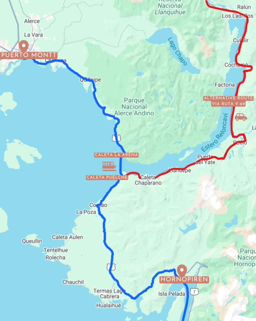
Just a few hours into the highway from Puerto Montt, you hit the first ferry. You can’t even reach the first major destination on the Carretera Austral, Hornopiren, without getting on a boat!
The highway pauses at the Estero Reloncavi, and there is a ferry to get from Caleta La Arena – Caleta Puelche. It’s the quickest ferry you’ll take, approximately 30 minutes.
It is run by Transportes del Estuario, with departures every single day of the year, usually every hour, 24 hours a day.
There is no need to book your ticket in advance. It’s first-come, first-served, and you just pay for your ticket in line before boarding.
The fee for a vehicle is 11,130 CLP (at the time of writing). Passengers are free, motorbikes and bicycles are cheaper and larger vans or motorhomes are more expensive. The latest prices are listed on the Transportes del Estuario website.
The total journey from Puerto Montt – Hornopiren, including the ferry, should be around 2.5 – 3 hours. I would highly recommend planning a stop in Alerce Andino National Park along the way (before the ferry if you’re travelling south).
💡 ALTERNATIVE: there is an alternative road route to bypass this ferry. If you don’t care about travelling the entire highway from end to end, you can use Ruta V-69 instead. It runs from Ensenada near Puerto Varas and the Parque Nacional Vicente Pérez Rosales, through Cochamao and Puelo, eventually connecting with the Carretera Austral near Caleta Puelche, bypassing the ferry crossing.
Hornopiren – Caleta Gonzalo (bi-modal route)
- 📍 Ferry route: Hornopiren – Caleta Gonzalo
- 🔃 Connecting destinations: Hornopiren – Chaiten
- ⛴️ Company: SOMARCO
- ⏰ Duration: ~4.5 – 5 hours
- 🗓️ Schedule: twice daily year-round, additional non-subsidised routes in summer
- 💰 Cost: 69,500 CLP for cars with one driver, additional passengers 11,600 CLP
- 🎟️ Pre-booking required: yes, book in advance, especially in summer
- ℹ️ More information: SOMARCO website

Just when you thought you’d finished with ferries for a while, the second one pops up almost immediately after the first!
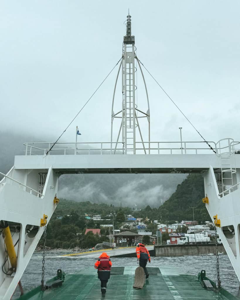
The Hornopiren barcaza (Hornopiren barge) runs from Hornopiren – Caleta Gonzalo. This route is booked as one trip, but it actually involves two ferries and a short drive in the middle. They call it a ‘bi-modal route’.
The port is right in the centre of Hornopiren town. You board this first boat for a ~3 – 4 hour journey across the Leptutu (also called the Comau) Fjord. The boat docks in Leptutu, and you will drive in a convoy for ~15 minutes across a narrow finger of forested land to the next dock, Fiordo Largo. From here, it’s ~45 minutes across the Lago Fjord to the final dock, Caleta Gonzalo.
This is the heart of Pumalin National Park, and as soon as you dock, you’ll see signs welcoming you to the park. From here, it’s a ~1 hour drive into the town of Chaiten, but depending on your mode of transport and accommodation arrangements, you might not head straight to town. There are several campgrounds and trails between Caleta Gonzalo and Chaiten.
The route is operated by SOMARCO and most departures are ‘subsidised’ by the Chilean Government, so the rate you see has been reduced.
It runs year-round, every day, twice per day. The current schedule is:
- ⬇️ Hornopiren – Caleta Gonzalo:
- 10:00 am
- 6:00 pm
- ⬆️ Caleta Gonzalo – Hornopiren:
- 12:30 pm
- 8:00 pm
In summer, they often run one additional trip per day, which is ‘non-subsidised’, so the fares are higher, but it does add some extra availability in peak times if you’re desperate.
You must book it online in advance, especially if you are travelling in the peak summer months. This route does book out.
The SOMARCO website is user-friendly and shows live availability, so if you’re not 100% sure of your plans or dates (we weren’t), you can keep an eye on how quickly the boat is booking out.
💡 ALTERNATIVE: there is an alternative ferry route from Pichicolo – Caleta Gonzalo. Pichicolo is a small town just north of Hornopiren, and this route is a direct ferry that does not require a boat change/drive in the middle. I believe Transportes Puelche is the main operator, but there are smaller, locally owned barges that also run the route.
There is another alternative to this route, which is to travel directly from Puerto Montt – Chaiten with Naviera Austral. You will skip a portion of the highway, but if you’re short on time and didn’t plan to stay in Hornopiren for any significant length of time, this is a good option.
Puerto Yungay – Rio Bravo
- 📍 Ferry route: Puerto Yungay – Rio Bravo
- 🔃 Connecting destinations: Cochrane/Caleta Tortel – Villa O’Higgins
- ⛴️ Company: Padre Antonio Ronchi and Pitipulla
- ⏰ Duration: ~1 hour
- 🗓️ Schedule: 4 – 10 times per day in either direction, dependent on the season
- 💰 Cost: free (government subsidised)
- 🎟️ Pre-booking required: no, first-in, first-served – line up early in summer!
- ℹ️ More information: provincial government Facebook page

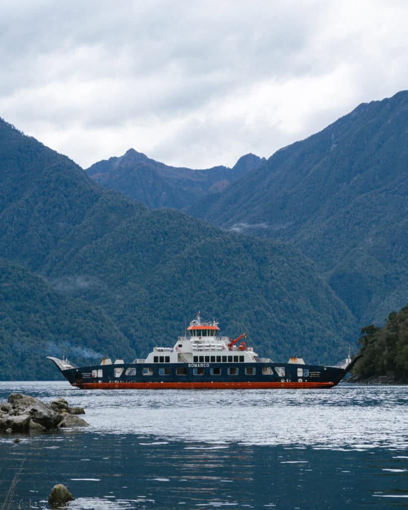
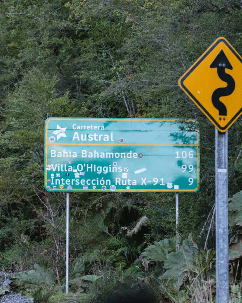
To get to Villa O’Higgins and the official end of the Carretera Austral, you have to take a ferry across the Mitchell Fjord from Puerto Yungay to Rio Bravo. The trip takes ~45 minutes – 1 hour.
The ferry is subsidised by the government, so it’s free. There is no pre-booking, it’s first-in-best-dressed, but in summer and other peak periods, you definitely need to line up early.
Both times we took the ferry, lots of people missed out. Including us on our way from Puerto Yungay – Rio Bravo, and we had to wait another two hours.
The times are very confusing as there are two different boats running ferries, but the signage at the ports is only for one. There is Padre Antonio Ronchi and Pitipulla.
There isn’t as much clear information about this route online as the other ones, but from what I can gather, the timetables are split into low, medium and high season.
I found the best information on the state (Aysen) and regional (Capitan Prat Province) government Facebook pages.
- Low season (temporada baja):
- 🗓️ April – September
- ⛴️ 4 ferries per day in either direction
- ⏰ Timetable
- Medium season (temporada media):
- 🗓️ October – December
- ⛴️ 8 ferries per day in either direction
- ⏰ Timetable
- High season (temporada alta):
- 🗓️ January – March
- ⛴️ 10 ferries per day in either direction
- ⏰ Timetable
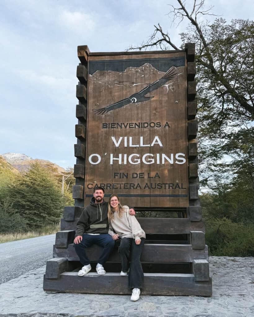
❌ NO ALTERNATIVE: there is no alternative to get to Villa O’Higgins and continue the Carretera Austral to the end.
There is a boat/hike/camp option from El Chalten in Argentina to Villa O’Higgins, but it is only possible on foot or with a bike, not with a vehicle. Ruedas de la Patagonia offers a package trip.

Other Carretera Austral ferries
There are various other ferries in this region across fjords, lakes and rivers to help move people and vehicles around the Carretera Austral. You might use them if you are planning a shorter route on the highway, or as an entry/exit point.
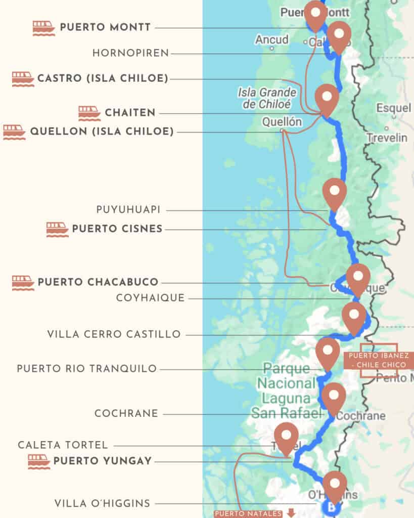
Ferries from Chiloe Island can help to form a circular route of the northern half of the highway, starting and ending in Puerto Montt, while the TABSA Ferry from Puerto Yungay – Puerto Natales connects the southern end of the highway to the rest of Chilean Patagonia in the deep south if you’re planning a one-way route.
There are a million possible route combinations that depend on more factors than I can cater for here! Instead, I’ll provide a list of the ferry routes (that I know of!) and where to find more information, and you can determine if they are suitable for your itinerary.
I’ve tried to keep them in a somewhat north – south list to help you visualise!
⚠️ There is another popular ferry route in the region, from Puerto Montt – Puerto Natales on the Navimag. This is a tourist-focused route with proper cabins on board (shared). It looks like an excellent trip with stunning scenery through the fjords, but it doesn’t actually help a trip on the Carretera Austral, as it bypasses the highway completely.
Puerto Montt – Chaiten
- ⛴️ Company: Naviera Austral
- ⏰ Duration: 9 hours
- 🗓️ Schedule: daily, year-round
- ℹ️ More information: Naviera Austral website
- 💡 Good for: saving time if you don’t want to stop in Hornopiren
Quellon (Chiloe Island) – Chaiten
- ⛴️ Company: Naviera Austral
- ⏰ Duration: 4.5 hours
- 🗓️ Schedule: 3 – 4 times per week
- ℹ️ More information: Naviera Austral website
- 💡 Good for: combining Chiloe with the Carretera Austral
Castro (Chiloe Island) – Chaiten
- ⛴️ Company: Naviera Austral
- ⏰ Duration: 6 hours
- 🗓️ Schedule: 1 time per week
- ℹ️ More information: Naviera Austral website
- 💡 Good for: combining Chiloe with the Carretera Austral
Quellon (Chiloe Island) – Puerto Cisnes
- ⛴️ Company: Naviera Austral
- ⏰ Duration: 12.5 hours
- 🗓️ Schedule: 4 – 5 times per week
- ℹ️ More information: Naviera Austral website
- 💡 Good for: creating a loop from Puerto Montt and the northern part of the highway
Quellon (Chiloe Island) – Puerto Chacabuco (Cordillera Route)
- ⛴️ Company: Naviera Austral
- ⏰ Duration: 28 hours
- 🗓️ Schedule: 1 – 2 times per week
- ℹ️ More information: Naviera Austral website
- 🔔 Other noteworthy stops: Raúl Marin Balmaceda, Puerto Cisnes
- 💡 Good for: creating a loop from Puerto Montt and the northern part of the highway
Puerto Ibanez – Chile Chico (Lago General Carrera)
- ⛴️ Company: Naviera Austral
- ⏰ Duration: 2 hours
- 🗓️ Schedule: 5 – 6 times per week
- ℹ️ More information: Naviera Austral website
- 💡 Good for: creating a round-trip loop from Coyhaique/Balmecada Airport
Puerto Yungay – Puerto Natales
- ⛴️ Company: TABSA
- ⏰ Duration: 41+ hours
- 🗓️ Schedule: once a week in low season, every 6 days in high season
- ℹ️ More information: TABSA website or read our experience on the TABSA ferry
- 🔔 Other noteworthy stops: Caleta Tortel
- 💡 Good for: connecting the Carretera Austral with southern Patagonia

Carretera Austral ferries: Final thoughts
I hope this practical post has helped explain the Carretera Austral ferries. We were quite confused before we visited, and deciphering outdated and incomplete snippets of information we found on the internet was tough.
Ferries are a way of life in this part of the world, and for many communities, they are their only connection to the outside world.
I update posts as frequently as I can, but the prices and schedules may change, so please use the links I’ve included to find the most up-to-date information before your trip.
If you’re planning a trip along the Carretera Austral, don’t forget to read my other articles below!
MORE CARRETERA AUSTRAL POSTS
- The Carretera Austral, Chile: Everything You Need to Know
- Our Epic 3-Week Carretera Austral Road Trip Itinerary
- TABSA Ferry: Sailing from Puerto Natales to Puerto Yungay
- Camping on the Carretera Austral, Chile: Our Tips & Tricks
- Camper Travel Chile 4×4 Camper Review: Our Experience



The Comments
Ralph
Is it possable to ride a ferry(s) from Santago to Punta Arenis? I have seen the ferry, i worked on a Antartic Science vessel (1995) the Polar Duke.
Sally Rodrick
RalphHi Ralph, I’m not aware of anything like that. I’m sure ships do travel that route, but I don’t know of any options for tourists, sorry! Sally