This article contains affiliate links that may earn me a small commission at no extra cost to you. As an Amazon Associate, I earn from qualifying purchases. For more information, see our affiliate disclaimer.
The Patagonia National Park is one of Chile’s newest and most exciting national parks. Considered one of the best places to see wildlife in Patagonia, the unique steppe landscape is a contrast to the snowy mountains and lush forests found in neighbouring parts of Southern Chile.
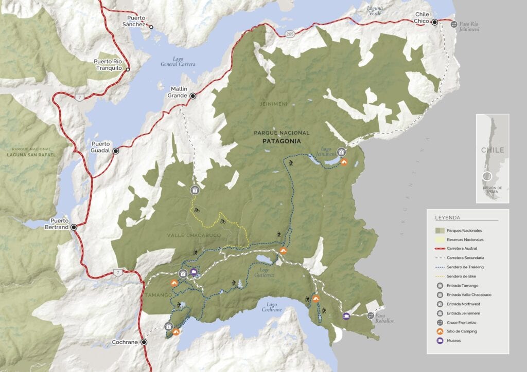
Created in 2018, the park spans more than 750,000 acres and is divided into three distinct sectors: Jeinimeni, Valle Chacabuco and Tamango.
The Tamango Sector of the park is the easiest sector to access, just a few kilometres from the town of Cochrane. A large town by Carretera Austral standards, this traveller’s hub has plenty of accommodations, food and amenities.
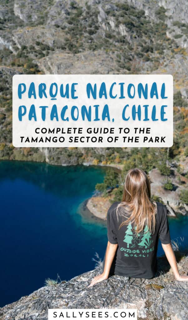
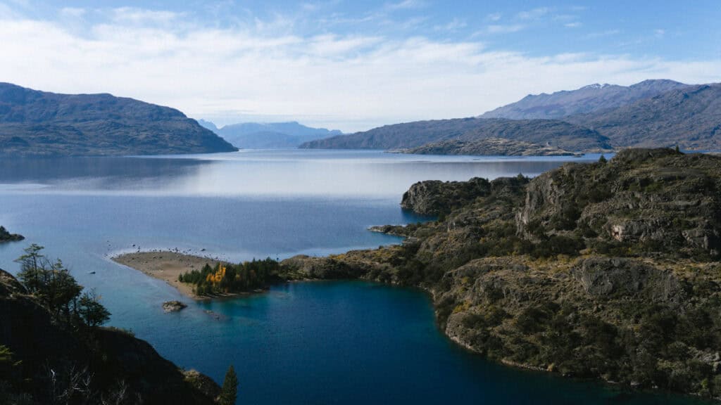
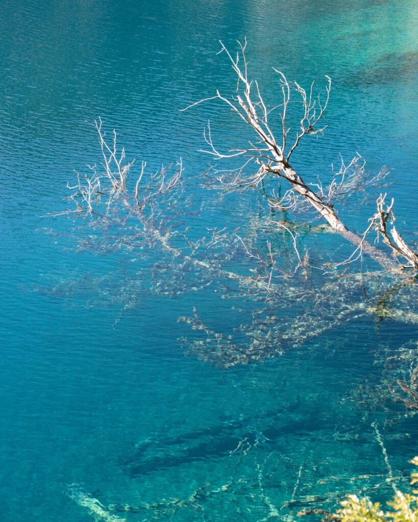
The Tamango Sector of Parque Nacional Patagonia is one of the best places in Chile to see the endangered huemul deer and has some stunning scenery, courtesy of the crystalline Rio Cochrane. This is seriously the most beautiful river we saw in all of Patagonia, and the blue colour of this water is reason alone to come to Tamango!
If you’re planning a visit to Parque Nacional Patagonia, don’t skip the Tamango Sector. This post contains everything you need to know to plan the perfect visit to this sector of the park, including access, hours and entry fees, amenities, camping options and the best trails to hike.


A brief history of Parque Nacional Patagonia
A relatively new national park in Chile, the Patagonia National Park was created in 2018.
It has a very interesting history, and we have the Tompkins family to thank for it.
‘Tompkins’ is a name you’ll hear quite frequently in Patagonia. Douglas Tompkins was the founder of The North Face, and his wife, Kristine, is the former CEO of the outdoor brand Patagonia.
The couple fell in love with the rugged lands of Patagonia back in the 1990s, and have since worked tirelessly to purchase land, restore and rewild it and eventually donate the land to the government to create new national parks.
This is how Parque Nacional Patagonia was formed.
In 2004, their nonprofit foundation, Tompkins Conservation (now Rewilding Chile), acquired almost 200,000 acres of land on the former sheep and cattle ranch Estancia Valle Chacabuco.
The foundation spent years undertaking intense ecological restoration projects and rewilding efforts, removing fences, recovering native flora and studying the behaviour and increasing presence of wildlife like pumas, guanacos and huemul deer.
In 2018, this land (among other land parcels around Chilean Patagonia, such as the Douglas Tompkins Pumalin National Park in Chaiten) was donated to the government. It was the biggest ever donation of private land to a government in history.
The Chilean Government combined two existing national reserves, Jeinimeni and Tamango, to the north and south of Valle Chacabuco, respectively, and Parque Nacional Patagonia was formed.
The park spans more than 750,000 acres in the Aysén region of Chilean Patagonia. It is divided into three ‘sectors’, reminiscent of how the park was created:
- 🏔️ Jeinimeni Sector: occupying the northern area of the park, the Jeinimeni Sector (formerly the Reserva Nacional Lago Jeinimeni) is probably one of the least visited parts of Patagonia National Park. It’s accessible from the town of Chile Chico and features glacial lakes, high mountains and alpine steppe.
- 🦙 Valle Chacabuco Sector: occupying the central area of Parque Nacional Patagonia, in an east-west valley, the Valle Chacabuco Sector is the most famous sector of the park. Its rugged Patagonian steppe feels entirely different to the mountains of the Aysen region, and the unique rock formations and grasslands feel more similar to Northern Chile than the rest of Patagonia. The park HQ and visitor centre are located in this sector, and it’s considered the best for seeing wildlife.
- 🦌 Tamango Sector: in the southern section of the park, not too far from the town of Cochrane, the Tamango Sector was formerly the Reserva Nacional Lago Cochrane o Tamango (seems they couldn’t agree on a name!). This sector covers the area around Lago Cochrane (also known as Lago Tamango) and the steep river valley running along the Rio Cochrane, descending from the slopes of Cerro Tamango. There are a lot of native forest zones in this sector, which are an important habitat for the endangered huemul deer.
🇦🇷 Chile’s Patagonia National Park runs all the way to the border with Argentina. Argentina also created a national park on their side of the border, called Parque Patagonia, and there are cooperative efforts by both countries to restore and preserve the landscape, and manage and increase wildlife populations. We didn’t have time to visit Argentina’s equivalent Parque Patagonia, but we have heard excellent things. It seems like a very well-run national park, and it’s still not a very popular attraction, so it’s a great place to get away from the crowds in Argentine Patagonia.

Save hours planning your Carretera Austral road trip with our Handbook + Custom Map

About Reserva Nacional Tamango
Sometimes still referred to by its old name, Reserva Nacional Tamango or Reserva Nacional Lago Cochrane, Tamango is now one of the three sectors of the official Patagonia National Park in Chile.
This sector of the park is one of the smallest, but that doesn’t mean it’s not worth visiting!
It’s steep topography rises from the Cochrane River Valley, where the sparkling blue waters flow into Lago Cochrane, before climbing to over 1,700 m on Cerro Tamango and dropping down the other side into the rugged Patagonian steppe of Valle Chacabuco.
Tamango wasn’t exactly what we had pictured when we thought of Parque Nacional Patagonia. We’d seen photos of vast plains, guanacos grazing on grasslands and unique rock formations rising out of the valley. That’s Valle Chacabuco.
But Tamango was a beautiful surprise, and this area was a lot more forested than we expected. With native lenga and ñirre forests, this sector of the park is the most important habitat for the endangered huemul deer, and although sightings are never likely, they’re very common in Tamango!
It’s one of the easiest sectors of the park to access, as you’ll read, and there are a variety of easy day hikes, water activities and amenities inside the park.
Entrance fees and opening hours
The Tamango Sector of the park is open every day of the year from 8:30 am. The last entry is at 5:00 pm, and the park closes at 5:30 pm, unless you are camping inside.
The entrance fee is 11,400 CLP (~$12 USD) for foreign adults.
You can buy your tickets online in advance via Chile’s Pases Parques Nacionales website if you like, but I don’t really think this is necessary. We were able to buy tickets on the spot at the national park office at the entrance of the sector, and we could pay by cash or card.
Getting to the Tamango Sector
The entrance to the Tamango Sector of the Patagonia National Park is located here, about 4 km (2.5 mi) from the centre of Cochrane town.
If you’ve got a car (which we really do recommend on the Carretera Austral) or a bicycle, it’s an easy drive, and there is a free car park at the entrance right near the ranger/ticket office.
If you don’t have a car, it’s definitely walkable from town, but just remember that you are adding 8 km (5 mi) onto any hike you do in the park.
We saw a few sad souls trudging back into town, looking very tired, after already hiking probably more than 10 km (6.2 mi). (We would have given them a lift, but we only had a 2-seat camper!).
There are a few taxis around town in Cochrane that could drop you off at the park. There is a list of names and numbers at the Tourist Information Centre in the Plaza de Armas. Otherwise, your accommodation in Cochrane could probably recommend a driver.
🚌 These directions assume you’re already in Cochrane. For info about getting to Cochrane, check out our travel guide.

Amenities in the Tamango Sector
Most of the amenities in this sector of the park belong to the campground (more on that below).
If you’re just visiting for the day, you can still make use of the amenities available at the campground. There are flushing toilets, covered seating areas and potable water taps.
Once you start the trails, there are no other amenities inside this sector. Make sure you pack plenty of water and snacks, and carry out any rubbish with you.

Camping and accommodation in the Tamango Sector
There is one campground in this sector of the park, called Camping Tamango.
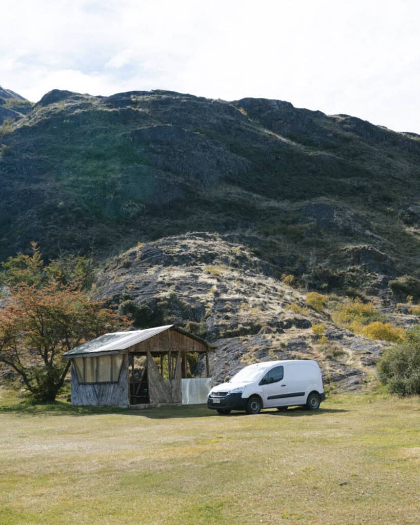
It’s 500 metres from the entrance to the park, and it’s possible to drive down this road and camp in a camper/motorhome/van. There are also lots of tent sites.
The campground is located right on the shores of the Rio Cochrane with stunning views. The park ranger told me that huemuls often hang around here.
It’s the starting point of most of the trails in this sector, so even if you’re not camping, you’ll wander past. Keep your eyes out for huemuls.
There are flushing toilets, showers (supposedly hot, but I wouldn’t count on it!) and covered picnic tables.
The campground is 8,000 pesos per person per night. It’s not possible to pre-book campsites in the Valle Chacabuco Sector of the park, but there is a WhatsApp number for Camping Tamango where I believe you can reserve a site in advance.
When we visited in April, there was only one van and one tent there, so unless you’re visiting in the height of summer, I don’t think booking in advance is really necessary.
There aren’t any other accommodations inside the boundaries of this sector of the park. There are some gorgeous cabins right outside, along the access road from Cochrane, such as Cabañas Brellenthin or Cabañas Canelita.
Otherwise, Cochrane town is just 4 km (2.5 mi) down the road and has a range of accommodations for all budgets. Check out my recommendations for hostels and hotels in my Cochrane guide.
Trails in the Tamango Sector
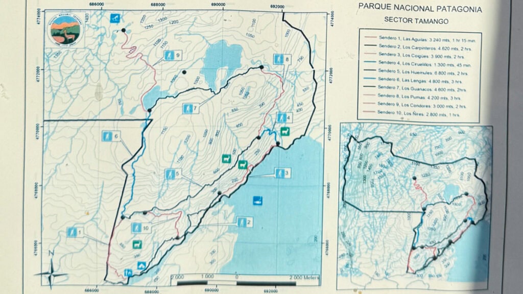
There are 10 trails in the Tamango Sector of the park. They are all numbered and have a specific name.
A lot of the trails build on others, e.g. to hike trail 9, Los Condores, you must hike trails 1 and 6 first. It’s a little confusing, but the maps at the park office are clear enough and we saw a fair few signs on the trails.
Unless you’re looking for a multi-day trek with off-grid camping that traverses the whole Tamango Sector or possibly into the Valle Chacabuco Sector, you’ll most likely hike one or both of the two trails that start from the park entrance.
SENDERO LOS CARPINTEROS #2
- 🥾 Trail type: out-and-back (can connect with other trails to form a loop)
- 📍 Trailhead location: ranger office at park entrance
- 🗺️ Trail map: AllTrails
- 📏 Distance: 9.5 km (5.9 mi)
- 📈 Elevation gain: 323 m (1059 ft)
- 🥵 Difficulty: moderate
- ⏰ Duration: 3 – 4 hours with stops
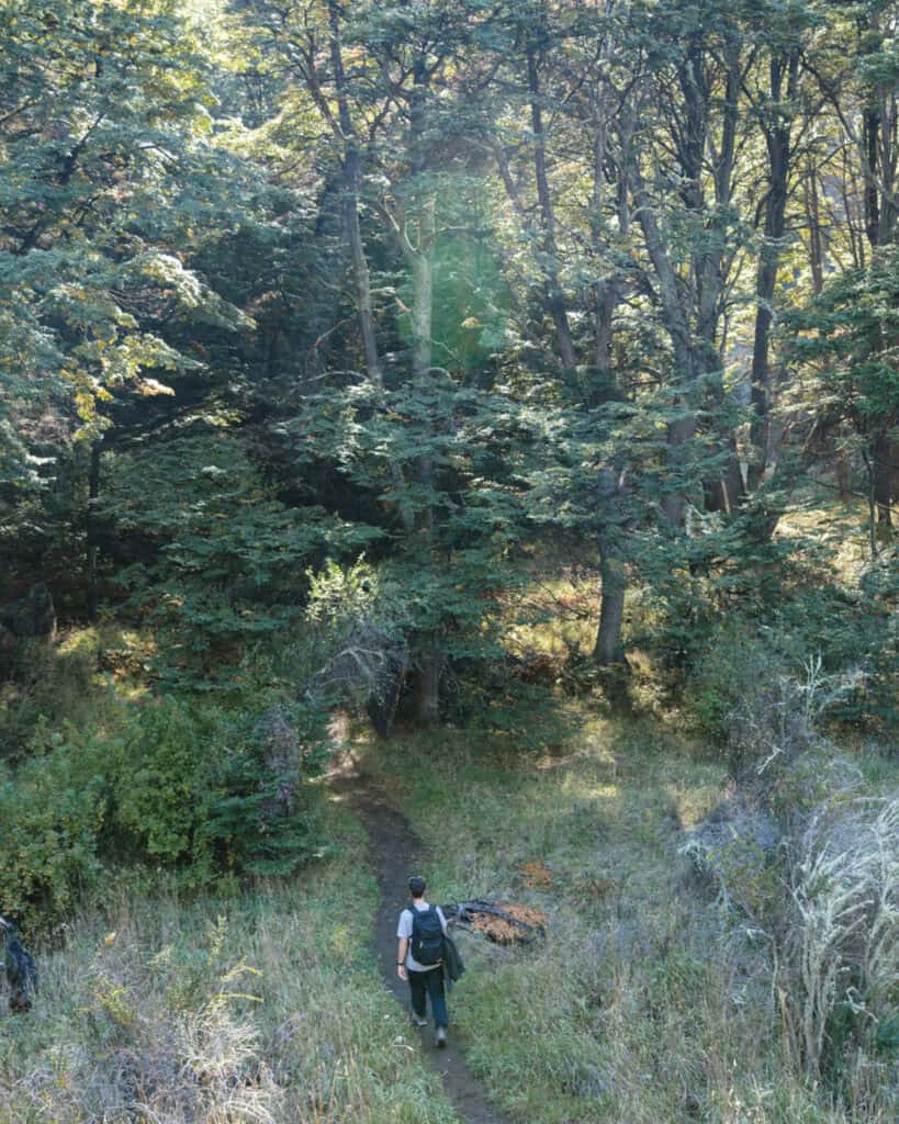
This was the trail we decided to hike in the Reserva Nacional Tamango and we absolutely loved it! It ended up being one of our favourite day hikes in Patagonia, and the scenery was so different to anything we’d experienced – mainly because of the GORGEOUS Rio Cochrane.
The simplest way to hike this trail is an out-and-back from the park entrance. It’s just under 10 km and follows the river for most of the way. It’s an undulating trail with constant ups and downs, but the ups never last for too long, and we found it quite gentle.
(We were recovering from a very nasty cold/flu, and this was our first big hike back. It turned out to be perfect as it wasn’t TOO tough).
The trail starts from the ranger office at the park entrance, and the first section is along a vehicle access road to the campground. Once you pass the camping area, you start to gently climb.
It’s exposed for most of the trail, which on a sunny April day was absolutely heaven for us, but I imagine it can get quite hot in summer. You’re climbing and descending an open rock face with a mostly clear view of the bright blue Rio Cochrane, which stopped me in my tracks and took my breath away on numerous occasions.
Eventually, the trail winds into the forest, which feels so magical. I was constantly on the lookout for huemuls, which are spotted quite regularly, but despite my manifestations, we didn’t see one (not here at least, we finally spotted one further north in Villa Cerro Castillo).
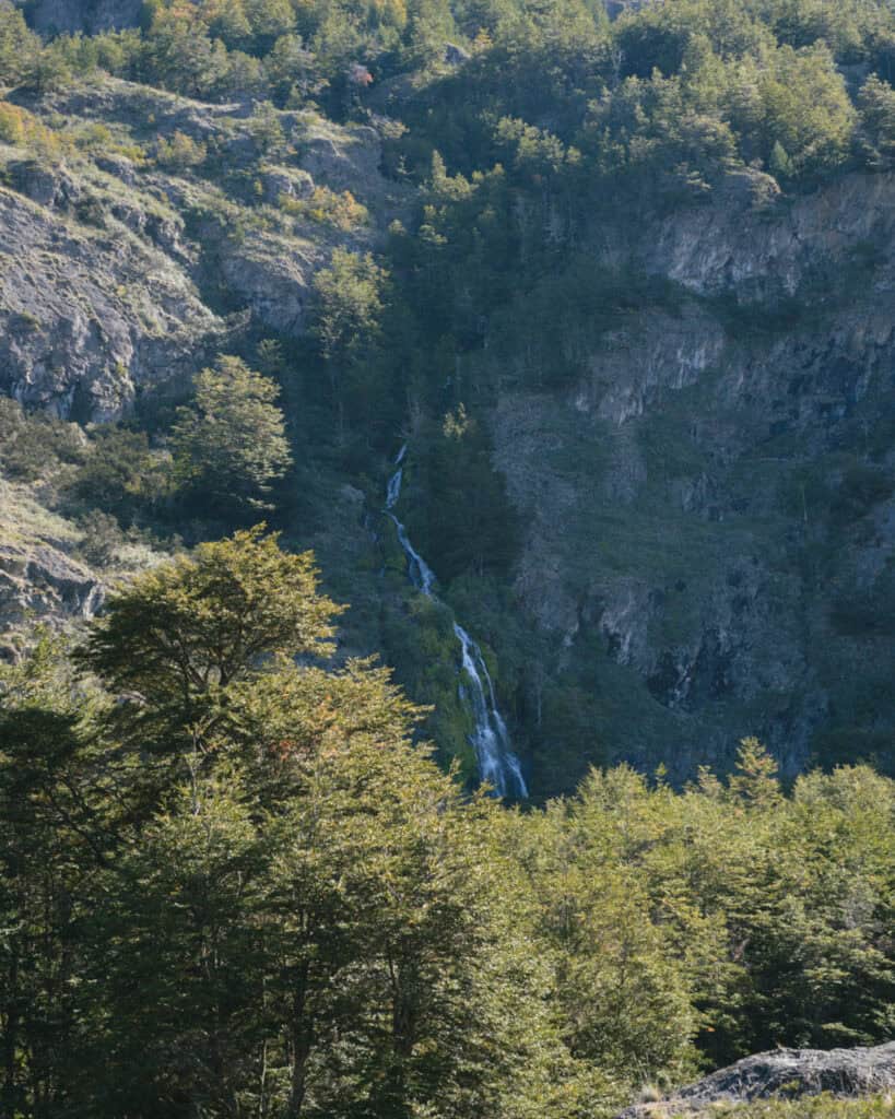
Keep your eyes out for a waterfall in the distance when you first start walking through the forest. As you approach the end of the trail, there are a few side paths you can take down to the riverbank, with a few small wooden piers making a great spot to stop for lunch or a snack.
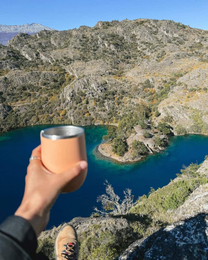
It’s a steep final slog up to the mirador, but so worth it for the view you get of the Rio Cochrane meeting the huge Lago Cochrane. We had a cuppa and our sandwich here and soaked up the vista before turning around and hiking back the same way. It was slightly easier with more decline on the return leg.
🚤 If for whatever reason you’re not up for a ~10 km hike, you can organise to hike this trail one-way by getting a boat transfer from the park entrance. Camping Tamango, as well as an external operator, Paseos Nauticos Cochrane, offer a one-way boat transfer to the end of the trail, and then you hike back to the entrance, halving the distance.


SENDERO LAS ÁGUILAS #1
- 🥾 Trail type: out-and-back (can connect with other trails to form a loop)
- 📍 Trailhead location: ranger office at park entrance
- 🗺️ Trail map: AllTrails
- 📏 Distance: 6.6 km (4.1 mi)
- 📈 Elevation gain: 428 m (1404 ft)
- 🥵 Difficulty: hard
- ⏰ Duration: 3 – 4 hours with stops
We didn’t take this trail, so I don’t have any personal insight, but from all accounts, it’s pretty tough.
It starts at the Tamango Sector entrance and ascends between the Tamango and Húngaro peaks. It’s up pretty much the entire way until the end of the trail, where you can either turn around and come back the way you came or connect with other trails (as below).
Given the elevation gain, this trail offers some nice views, but most people say it’s mostly of the town of Cochrane and the forest, not so much of the lake or river.
Personally, I wouldn’t choose this trail over the Los Carpinteros Trail unless you’re planning to combine it with other trails to form a loop, which I’ve outlined below.
MAKE IT LONGER
If you want to see more of the Tamango Sector, you can create a loop that combines these two trails with part or all of some other trails that begin further into the park.
OPTION #1 ~13 KM (8 MI)
This is the shortest way you can turn the Los Carpinteros Trail (#2) into a loop trail. You should start from the park entrance on the Las Águilas Trail (#1) for 3.24 km (2 mi). Then you connect with a very short portion of the Los Huemules Trail (#5), approx 500 metres (1,640 ft), before meeting the Los Ñires Trail (#10) for 2.8 km (1.7 mi). This trail connects with the Los Carpinteros Trail (#2) and you hike east to the end of the trail for approximately 2 km (1.2 mi), before turning around and following the Los Carpinteros Trail all the way back to the park entrance (2 km (1.2 mi) + 2.7 km (1.7 mi)).
This is about 13.2 km (8.2 mi) and would make for an excellent day hike. With hindsight, if we were feeling better, we would have loved to do this, and it allows you to ascend a little higher on the Las Aguilas trail and get some elevated views of the landscape.
OPTION #2 ~20 KM (12 MI)
If you’re up for a longer, all-day hike, you can create a loop that combines five trails. Start with the Las Águilas Trail (#1) for 3.24 km (2 mi). Then you connect with the Los Huemules Trail (#5) for 6.8 km (4.2 mi). This eventually reaches a junction where you want to take the Los Ciruelitos Trail (#4) for 1.3 km (0.8 mi) to connect with the Los Coigües Trail (#3). This trail runs for 3.9 km (2.4 mi) before it meets the Los Carpinteros Trail (#2), and you can hike the entire trail one-way back to the park entrance for 4.62 km (2.9 mi).
This is 19.86 km (12.3 mi) total, and would be doable in a day for experienced hikers if you started first thing.


Other activities in Reserva Nacional Tamango
In addition to hiking the beautiful trails, you can enjoy the Rio Cochrane!
There are plenty of places along the Los Carpitenteros Trail to jump in for a (freezing) swim if you’re brave enough in the summer. You can also access the river for a swim from the campground.
It’s possible to rent kayaks at the campground in the park. Unfortunately, this information was on a sign we saw in the campground at Valle Chacabuco (after we’d already left!), so we didn’t take up this opportunity, but so wish we did!
The prices we saw were singles (15,000 CLP) or doubles (25,000 CLP) for a 3-hour rental.
The campground also offers boat rides along the river, either as a one-way drop to hike back along the Los Carpinteros Trail or just as a leisurely round-trip tour to enjoy the water.
Paseos Nauticos Cochrane is another great local company that offers a variety of boat, kayak and fishing tours and can also offer boat drops into the national park.


Wildlife to look out for
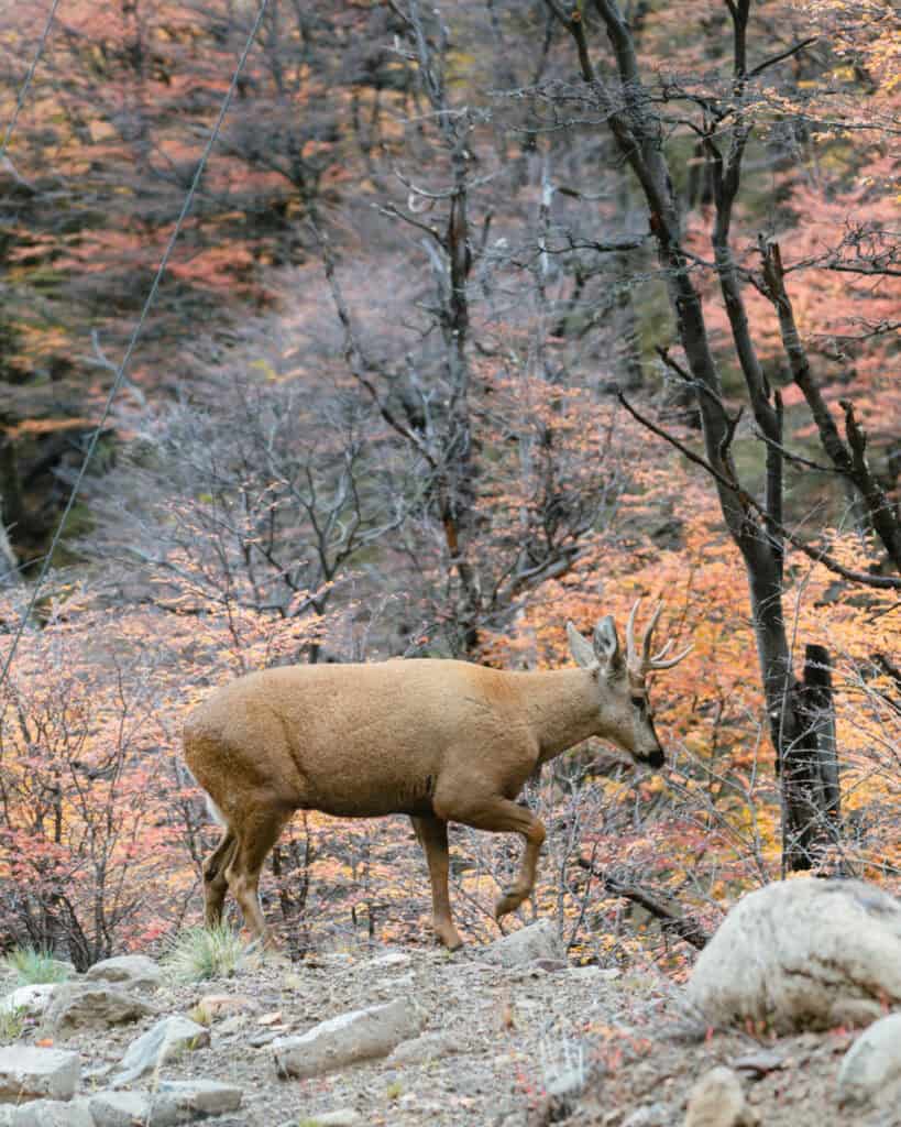
The Tamango Sector is the place to see the endangered huemul deer in the Patagonia National Park.
Did I spend the entire hike shushing Brayden and watching and listening intently? Yes. Did we see any here? No.
We weren’t lucky, but LOTS of people are. There is a very good chance of seeing a huemul here, and this is considered one of the best places to see them in all of Chile. Although sightings are never guaranteed, I’d go as far as saying they are common in this part of the park.
The ranger we spoke to at the entrance said they are most commonly sighted around the campsite, so keep your eyes and ears peeled from the very beginning.
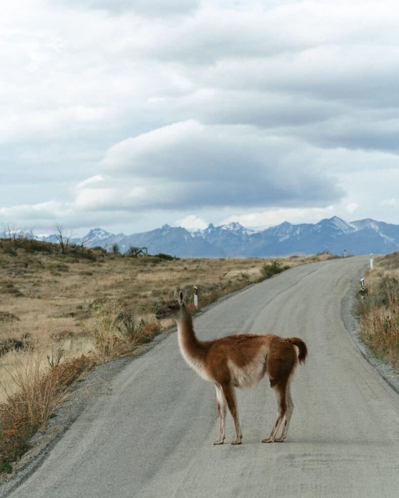
There is a ton of wildlife living inside the park, but you’re not as likely to spot animals like guanacos, pumas or nañdus in Tamango.
In addition to the huemuls, you might be lucky enough to see woodpeckers (aka carpinteros in Spanish), foxes, trout in the very clear waters of the river, and a variety of other birdlife. We also saw so many butterflies in the forest, which felt magical.
What to bring
This is our go-to day-hike packing list for Patagonia.
We amend it slightly depending on the trail distance and terrain, and weather conditions, but as a base, this is everything we think about before a long day hike. Never forget that the weather in Patagonia can change on a dime, so even if you set out hiking in sunshine, you need extra layers for wet or freezing conditions.
- 💦 Water bottles x 2 per person
- 🫧 Electrolyte sachets
- 🍭 Lollies
- 🥪 Lunch or snacks
- 🍴 Reusable cutlery kit (if required for food)
- ♨️ Thermos with hot water
- ☕️ Reusable coffee cup
- 🫖 Tea or coffee bags
- 🥾 Hiking poles
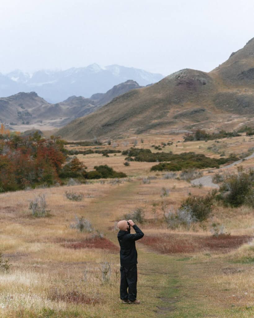
- 👀 Binoculars
- 🔦 Head torches
- 🧢 Hat
- 😎 Sunglasses
- 🧴 Sunscreen (reef-friendly)
- 🦟 Insect repellent (natural)
- 🧥 Rain coat and pants
- ☔️ Dry bags and/or waterproof bag cover
- 🧣 Gloves, scarf/buff and beanie
- 🥶 Extra warm layers
- 🧦 Spare pair of socks
- 🩳 Shorts to change into if warm
- 🧖🏽♀️ Towel (if swimming)
- 👙 Bathers (if swimming)
- 🩹 Mini first aid kit and medicines
- 🧻 Tissues and/or toilet paper
- 🚽 SheWee
- 📱 Charged phone with trail map downloaded offline
- 📷 Camera with spare batteries and memory card
- 📚 Ereader
- 🔌 Powerbank and phone cord
Planning a trip to Cochrane
The Tamango Sector of the Patagonia National Park is right near the small town of Cochrane. If you’re planning a trip to Cochrane or the Carretera Austral more broadly, don’t forget to read our Cochrane travel guide too. It covers all the important info you need to know about Cochrane, like getting there, getting around, the best places to eat, where to stay and other handy tips to get your bearings.
🦌 Everything you need to know about Cochrane

Final thoughts: Reserva Nacional Tamango
Our only regret when visiting the Tamango Sector was that we didn’t stay for longer! And that we weren’t feeling good enough to hike a little further.
We absolutely adored the town of Cochrane, and we could have easily spent a few more nights there, coming back to this part of the park over consecutive days.
Valle Chacabuco is as good as everyone says it is, but don’t underestimate Tamango either.
I hope this post has helped you understand a bit more about how to visit Parque Nacional Patagonia. I was a bit confused beforehand about the different sectors, campgrounds and trails, but hopefully this has demystified things for you!
Don’t forget to check out our Cochrane guide, the jump-off point for the park, and also our guide to the Valle Chacabuco Sector, which you MUST also visit.
MORE COCHRANE POSTS
- Cochrane, Chile Travel Guide: Patagonia’s New Hiking Hub
- Parque Nacional Patagonia: Valle Chacabuco Sector